
GPS Satellite View: Live Maps
Live Satellite Maps For Global Earth View
Screenshots


Discovering the World with GPS Satellite View: Live Maps
Have you ever wanted to travel the world without leaving your home? GPS Satellite View: Live Maps makes that possible. It's like having a magic window to the entire globe right on your phone. Let me tell you why this app is so great and why you should give it a try.
A Guide That's Easy to Use
First things first, this app is super simple to use. The design is clean and intuitive, so you don't have to be a tech expert to get the hang of it. With just a few taps, you can search for any place, zoom in for a closer look, or zoom out to see the bigger picture. It’s designed to be hassle-free for everyone.
Cool Tools for Your Adventures
Now, let's talk about the fun features. This app is packed with awesome tools. You can look at live maps, check real-time traffic, and even explore locations in 3D. It feels like you're flying over the city! The satellite pictures are incredibly sharp and detailed.
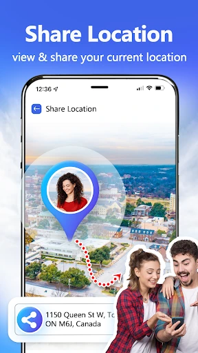
There's also a street view feature that's really handy. It's perfect for when you're planning a vacation and want to see what a neighborhood looks like before you go. Whether you're looking at a potential hotel or just being nosy about a new place, this feature is a real winner.
Information as It Happens
One of the best parts of GPS Satellite View is how current it is. If you're driving to work or heading out on a trip, knowing the traffic is key. This app gives you live traffic updates, so you can steer clear of delays and find the fastest way to get where you're going.
Travel the Whole Planet
Got an urge to explore? This app lets you visit anywhere on Earth. You can wander through the busy markets of Marrakech or relax virtually on a quiet Caribbean shore. You can also switch between different types of maps to see what you like best—satellite images, terrain maps, or a mix of both. The choice is yours.
Wrapping It Up
So, that's the lowdown! GPS Satellite View: Live Maps is an essential app for anyone who's curious about the world. It's ideal for planning your next holiday, discovering new spots, or just feeding your wanderlust. The app is free to download, with some optional extras you can buy to make it even better.
In short, it's a wonderful tool for both serious travelers and dreamers. Don't wait—download it now and begin your online tour of the world. Happy virtual travels
Advantages
- Real-time satellite imagery
- Accurate GPS navigation
- User-friendly interface
- Offline maps available
- Customizable map settings
Disadvantages
- Requires internet for live view
- High battery consumption
- Occasional map lag
- Ads can be intrusive
- Limited features offline
Frequently Asked Questions
Q: What features does GPS Satellite View: Live Maps offer?
A: GPS Satellite View: Live Maps offers a variety of features including real-time GPS tracking, satellite imagery, street view, and live map updates. Users can explore different locations around the globe with detailed visuals, plan their routes with precision, and access up-to-date traffic information to optimize their travel experience.
Q: Is GPS Satellite View: Live Maps free to use?
A: Yes, GPS Satellite View: Live Maps is free to download and use. However, it may offer in-app purchases or premium features that require payment. Users can enjoy basic functionalities without any cost, but opting for premium features can enhance their experience with additional tools and ad-free usage.
Q: How accurate is the GPS tracking in GPS Satellite View: Live Maps?
A: The GPS tracking in GPS Satellite View: Live Maps is highly accurate, utilizing advanced GPS technology to provide precise location data. However, its accuracy can be affected by several factors including the device's GPS hardware, signal strength, and environmental conditions such as tall buildings or dense forests, which might interfere with signal reception.
Q: Can I use GPS Satellite View: Live Maps while offline?
A: GPS Satellite View: Live Maps primarily requires an internet connection to access live map updates and satellite imagery. However, users can download certain maps for offline use, allowing them to navigate without an internet connection. This feature is particularly useful for travelers who may not have reliable internet access at all times.
Q: What platforms is GPS Satellite View: Live Maps available on?
A: GPS Satellite View: Live Maps is available on both Android and iOS platforms, making it accessible to a wide range of smartphone users. It can be downloaded from the Google Play Store for Android devices and the Apple App Store for iOS devices, ensuring compatibility with most smartphones and tablets.
Technical Information
Recommended for You

mobile.de - car market

Scoreboard - Keep score

Cheetah Leopard Wallpaper

LUDEX Sports Card Scanner +TCG

Publix

Perfect Piano

When I Work Team Scheduling

FPL

ProCCD - Digital Film Camera

Red Lobster Dining Rewards App

MatchLive: Football Live Score

ExtraMile Rewards®

PDF Reader - PDF Editor

Make Money: Play & Earn Cash

All Video Downloader Master

W.W. Grainger, Inc.

Babysits - Find Babysitters

Smart Life - Smart Living

Penly: Digital Planner & Notes

DailyGift: Earn Reward

OAN: Live Breaking News

Baskin-Robbins

Videoleap: AI Video Editor App
