
GPS Satellite Live Earth Map
Live Satellite Maps For Outdoor Navigation
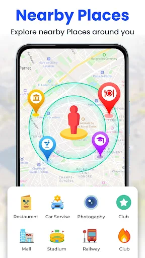
Screenshots
Live Satellite View, GPS Maps: Your Window to the World
Have you ever wanted to see any place on Earth from above without needing to get on a plane? Well, the Live Satellite View, GPS Maps app could be the answer. This clever app mixes the wonder of satellite pictures with the ease of your phone, giving you a special way to discover the world. Let's take a look at why this app is so great for travel lovers and the naturally curious.
Exploring the Globe from Your Living Room
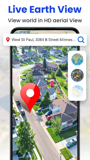
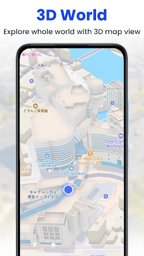
Picture yourself wandering through Paris or soaring above the Grand Canyon, all from the comfort of your sofa. The Live Satellite View, GPS Maps app puts the whole world in your hands. Its high-definition satellite pictures let you zoom in and out of places, getting a close-up look at landscapes, cities, and even your own street. It's like having your own personal drone, but without the high cost or tricky controls.
Smooth and Simple Navigation
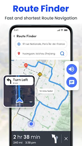
What I really like about this app is how easy it is to use. Moving between different features is simple because of its smart design. The built-in GPS function helps you find your way around without any hassle, whether you're organizing a vacation or just browsing for fun. And with live updates, you're always in the know, no matter where you are.
Noteworthy Features
This app is full of tools that are both useful and fun. Here are some of the best ones:
Live Satellite Imagery: See up-to-date pictures of various spots across the planet.
Street-Level Exploration: Drop down to street level and check out areas as if you were really there.
Find New Places: Use the search tool to look for a specific location or let the app pick a random one for you to discover.
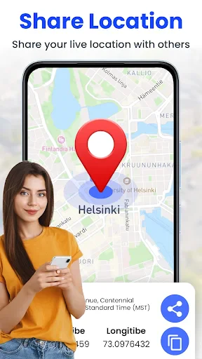
Keep and Share: Take snapshots of your favorite views to share with others or save for yourself.
Your Go-To Tool for Trip Planning
If you're the type who likes to plan every part of your journeys, this app changes everything. The detailed maps and satellite views let you investigate possible places to visit and plan your schedule accurately. You can look at what's around your hotel, find points of interest close by, and figure out the best travel paths. It's like carrying a personal tour guide in your pocket!
A Couple of Small Drawbacks
Even though there's plenty to enjoy about Live Satellite View, GPS Maps, it does have a few small quirks. Sometimes the app might run a little slow, particularly if your internet connection isn't very fast. The satellite pictures are usually clear, but they can be a little old sometimes, which might be disappointing if you were hoping for the very latest view. But in the grand scheme of things, these are small points when you consider all the great tools the app provides.
Wrapping Up
In a time when technology makes the world feel smaller, apps like Live Satellite View, GPS Maps turn exploring into an easy and enjoyable activity. Whether you're using it for getting around, organizing a trip, or just to feed your curiosity from home, it's a wonderful resource to have. So why not download it and begin your global tour without even getting up? Your next big discovery might be right there, waiting on your phone!
Advantages
- Real-time satellite imagery available.
- User-friendly interface for easy navigation.
- Accurate GPS location tracking.
- Wide coverage of global maps.
- Frequent updates with new features.
Disadvantages
- Requires constant internet connection.
- High data usage for satellite images.
- Limited offline capabilities.
- Some features require in-app purchases.
- May drain battery quickly during use.
Frequently Asked Questions
Q: What is Live Satellite View, GPS Maps and what features does it offer?
A: Live Satellite View, GPS Maps is a navigation application designed to provide real-time satellite imagery, interactive maps, and GPS navigation. It offers features such as live street views, traffic updates, route planning, and location sharing, making it a comprehensive tool for travelers and daily commuters seeking accurate and up-to-date information.
Q: How accurate is the live satellite imagery provided by the app?
A: The app offers high-resolution satellite imagery that is frequently updated to ensure accuracy. While the live satellite view provides a close approximation of real-time visuals, slight delays or discrepancies may occur due to processing times and satellite coverage. Users can generally rely on the app for precise navigation and location details.
Q: Does Live Satellite View, GPS Maps require an internet connection to function?
A: Yes, the app requires an active internet connection to access live satellite images, real-time traffic updates, and other dynamic features. Offline maps may be available for basic navigation, but the full range of features, including live updates and satellite views, necessitates a stable internet connection for optimal performance.
Q: Is Live Satellite View, GPS Maps free to use, or are there any in-app purchases?
A: The app is free to download and offers a variety of basic features at no cost. However, it may include in-app purchases or subscription options to unlock premium features such as ad-free usage, enhanced map details, and additional customization options. Users can choose to upgrade based on their navigation needs and preferences.
Q: How user-friendly is the app for first-time users?
A: Live Satellite View, GPS Maps is designed with an intuitive interface that is easy to navigate for first-time users. It provides clear instructions and helpful tooltips to guide users through its features. The app also includes comprehensive tutorials and a user support section to assist with any questions or difficulties new users may encounter.
Technical Information
Recommended for You

Recover Deleted Messages

Photo Scan App by Photomyne

Cash’em All: Play & Win

ThemePro - Widget & Wallpaper

Zillow: Homes For Sale & Rent

NextLog

Kahoot! Play & Create Quizzes

Bobby Approved

Job Search by ZipRecruiter

Little Nightmares Comics

MD332 Digital watch face

Illinois Tollway

Headunit Reloaded Emulator HUR

Thrift Savings Plan

YouTube Music

Alaska Airlines - Travel

theCut: Barbershop Booking

Bird — Ride Electric

OnePlayer - Video Downloader

Torque Pro (OBD 2 & Car)

Bath & Body Works

Sonic Video

PDF Reader: Read all PDF files
