
onX Backcountry Trail Maps GPS
Offline GPS Maps For Backcountry Navigation
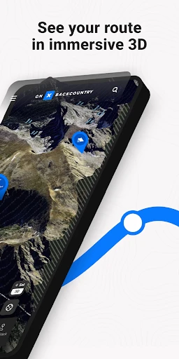
Screenshots


Discovering the Great Outdoors with onX Backcountry Trail Maps GPS
Hey there, fellow adventurers! If you're anything like me, the call of the wild is a siren song that can't be ignored. That's why I was psyched to try out the onX Backcountry Trail Maps GPS app. Now, I’ve always been a sucker for a good hike, and this app promised to be my new best friend in exploring the unbeaten paths. Let me take you through my experience with this nifty tool.
Getting Started with a Smooth and Simple Design
Right from the start, the app's clean and straightforward look was a winner. The layout is super simple, so you're not stuck messing with your phone when you should be soaking up the scenery. It's a breeze to use, even if you're not the most techy person. The main screen gives you quick access to everything you need, like trail info, weather reports, and your saved maps.
A total lifesaver is being able to save maps to use when you have no signal. This is a huge deal for anyone who loves to wander way off the grid. You can stop worrying about getting lost when you're deep in the backcountry with no bars in sight!
Planning Your Adventure with In-Depth Trail Intel
This app does more than just point the way; it makes your whole trip better. You get super detailed topo maps that show you the lay of the land, what's growing there, and where animals might be hanging out. How awesome is that? You can pick your route based on what you want to experience. Feel like a walk in the woods or a scramble up a cliff? onX has you covered.
Another feature I found really useful is the live weather info. I've lost count of the hikes I've started in sunshine that ended with me getting soaked by a surprise storm. With this app, you can check the forecast right before you head out and even while you're on the move. It's like having your own personal meteorologist right in your pocket!
Staying Safe with Reliable Location Tools
Staying safe is the number one priority when you're out in nature, and onX really gets that. The GPS location feature is super accurate, letting you see exactly where you are at all times. This is perfect for when you're hiking alone and want that extra sense of security. You can also send your live location to friends or family, so someone always knows your spot.
I also thought the feature that records your path was really neat. It's a great way to keep a log of your hikes, see how far you've gone, and maybe do a little showing off about the amazing trails you've finished. Everyone likes to share their adventures, right?
The Bottom Line: Should You Get This App?
So, is the onX Backcountry Trail Maps GPS app worth getting? For sure! Whether you're a pro hiker or just starting your outdoor journey, this app has something to offer you. It mixes powerful tools with an easy-to-use design, making it an essential download for anyone who loves getting outside.
To sum it all up, if you want to step up your hiking and explore nature with more assurance, onX is a great pick. Its wide range of features makes sure you're ready for anything the wilderness has in store. So, tie up your boots, pack your gear, and let's get exploring with onX showing the path
Advantages
- Detailed topographic maps available.
- Reliable GPS tracking in remote areas.
- Offline map access for no signal zones.
- Comprehensive trail information provided.
- User-friendly interface for easy navigation.
Disadvantages
- High battery consumption.
- Limited free features.
- Occasional map loading delays.
- Subscription required for full access.
- Requires large storage space.
Frequently Asked Questions
Q: What features does onX Backcountry Trail Maps GPS offer?
A: onX Backcountry Trail Maps GPS provides comprehensive features for outdoor enthusiasts, including detailed topographic maps, GPS tracking, offline map access, and custom waypoint creation. The app is ideal for hiking, biking, and skiing adventures, offering real-time conditions updates, terrain analysis, and safety features like SOS signaling to ensure a safe and well-planned trip.
Q: Is onX Backcountry Trail Maps GPS available offline?
A: Yes, onX Backcountry Trail Maps GPS offers offline map access, allowing users to download maps in advance and use them without an internet connection. This feature is particularly beneficial for adventurers exploring remote areas where connectivity is limited, ensuring continuous access to trail data and navigation tools.
Q: How accurate is the GPS tracking in onX Backcountry?
A: The GPS tracking in onX Backcountry is highly accurate, utilizing advanced satellite technology to provide precise location data. The app allows users to track their routes in real-time, mark waypoints, and measure distances, making it a reliable tool for navigating unfamiliar terrains and ensuring users stay on the right path.
Q: Can I customize my trail maps in onX Backcountry?
A: Yes, onX Backcountry allows users to customize their trail maps by adding waypoints, notes, and photos. Users can also highlight specific trails and share their customized maps with friends or other app users. This customization helps personalize the experience and enhances planning by focusing on areas of interest or concern.
Q: What kind of subscription plans does onX Backcountry offer?
A: onX Backcountry offers various subscription plans to suit different needs, including monthly and annual options. Subscribers gain access to premium features like offline maps, advanced tools, and exclusive content. Users can also explore a free trial before committing to a subscription, providing a risk-free opportunity to experience the app's full capabilities.
Technical Information
Recommended for You

MyMercy+

Pi Browser

Parental Control App Blocker

NetShare - no-root-tethering

Learn To Draw Step By Step

Cinemark Theatres

Astonishing Comic Reader

Online chat, calls - Gem Space

Notepad - simple notes

Uber Eats Orders

Cast to TV - Screen Mirroring

PicFrame

Switch Natural

TrueCar Used Cars and New Cars

iTunes

99acres Buy/Rent/Sell Property

O’Reilly First Call VIN Scan

Bounce: Luggage Storage Nearby

Weather Radar - Meteored News

FX File Explorer: Plus License

PhoneFixer-Memory Cleaner

Upgrade

Driver Written Test: 2025 Test
